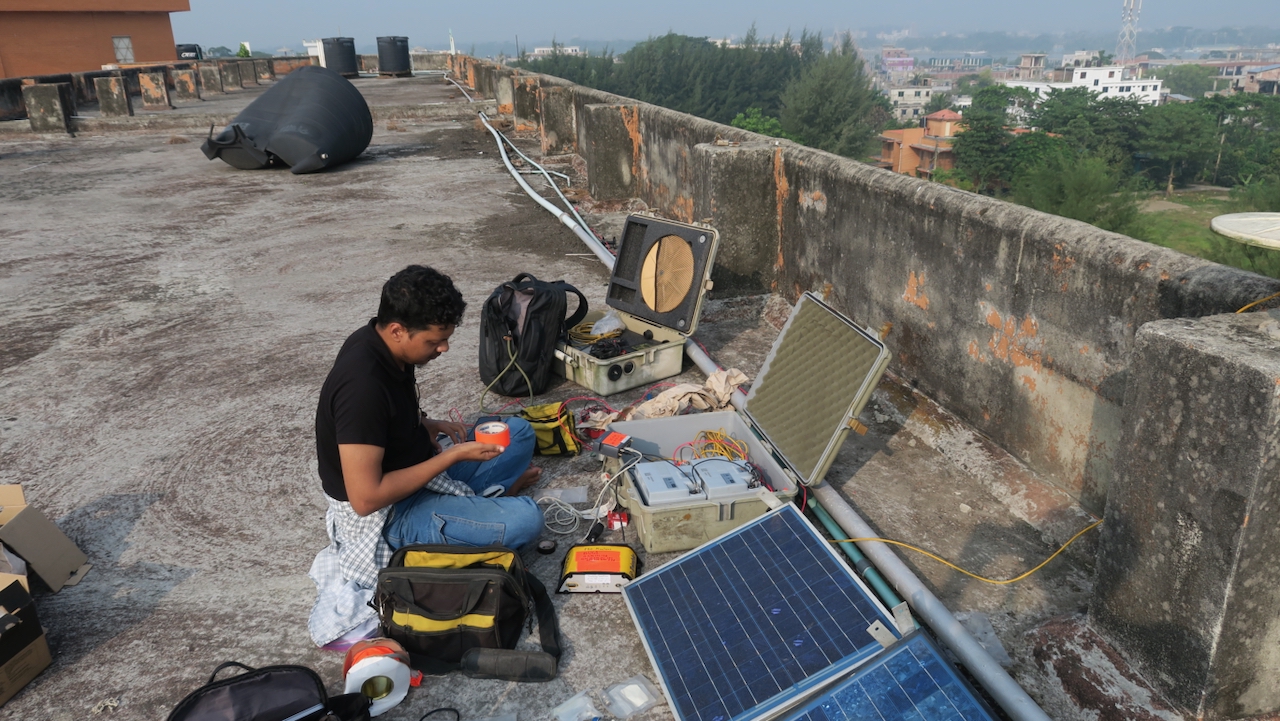
I’m here in Bangladesh repairing my global navigation satellite system (GNSS) stations, which record the tectonic motions of the plate boundary and the subsidence of the Ganges-Brahmaputra Delta, the largest in the world. I am traveling with Adam Woolace, an EarthScope Consortium engineer and Sanju Singha and Zohur Ahmed from Dhaka University. Having finished repairing our stations in Sylhet in NE Bangladesh, we left Sreemongal and headed to Comilla. While the road near Brahmanbaria wasn’t as difficult as last time, bad roads and traffic made the trip 7.5 hours instead of 6.
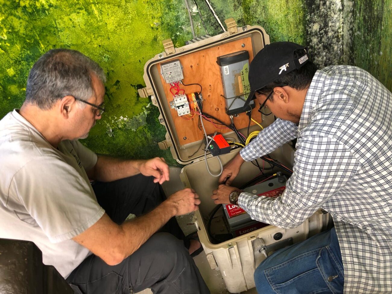
We headed to Comilla University, where we have a system on the roof of one of the buildings. After waiting for them to find the key and going through administration approvals, we finally got to the roof, but had to break into the room with our equipment, drilling through the lock. Luckily, the repairs were simple—replacing the battery, adding a low-voltage disconnect to protect it and correcting some wiring.
When we were done, we headed for the city of Comilla, where Singha had talked a four-start hotel into giving us rooms at half price. We enjoyed our night of comfort before heading west in the morning to Raipur, our last stop for the stations in the tectonically active eastern part of Bangladesh. When we arrived, we found that the army had taken over the government guest house at our station. After the July uprising last year that toppled the government, the army deployed to cities across the country to help maintain security. To get in, we needed approval of the commanding officer, who was off at the weekly midday Friday prayers. After an hour of explaining and waiting, we were finally able to get to the roof. With the sergeant looking on, we were able to get the station working in less than an hour.
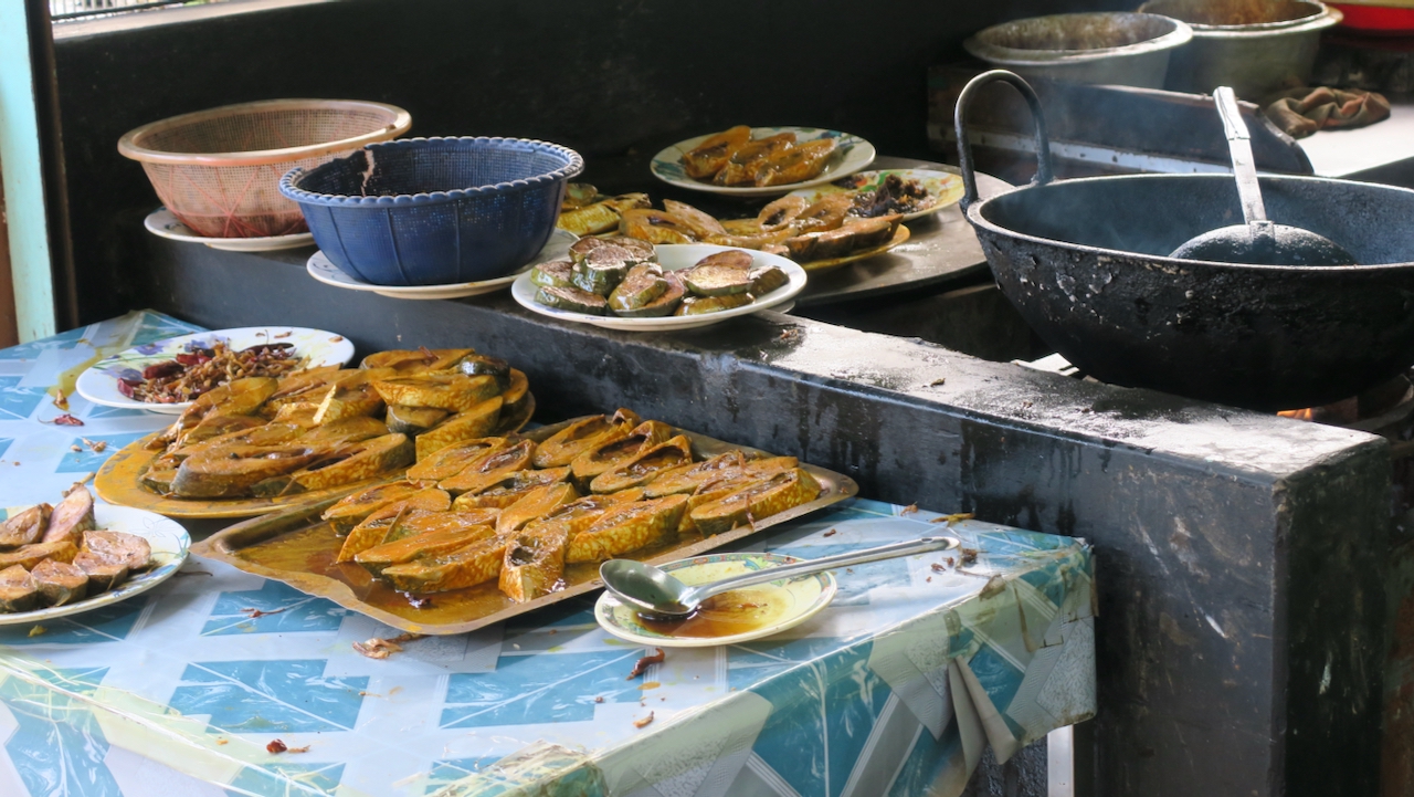
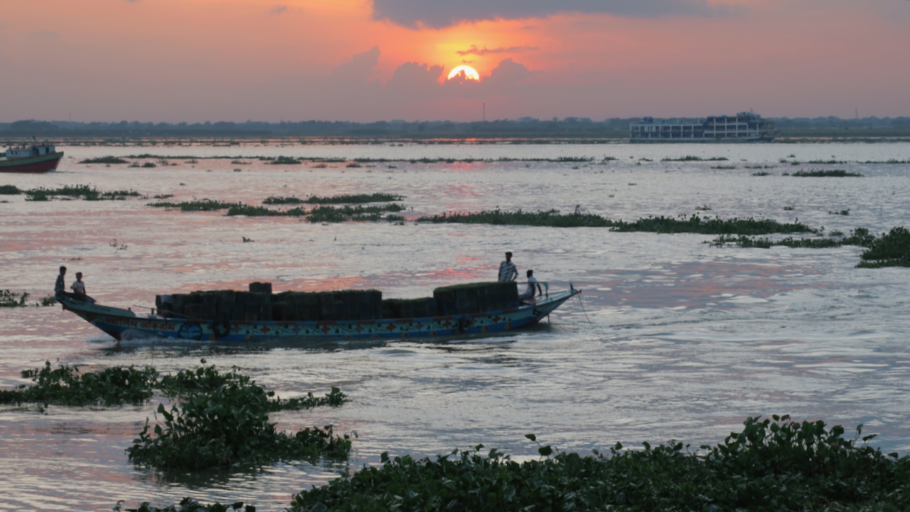
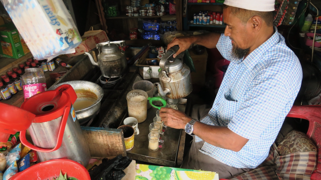
We headed back to Dhaka, stopping at Chandpur (a major port of the Meghna River) at 4 p.m. for lunch. We had freshly grilled hilsha in mustard oil, the national fish of Bangladesh, with grilled eggplant. We then walked about the park at the shore looking across the broad river to the barely visible other side. Chandpur is where the Upper Meghna meets the Padma River (the combined Ganges and Brahmaputra) to form the Lower Meghna River. It’s peak flow is probably higher than any river except the Amazon. We watched the sun set over the river and then, before we left the crowded park, we had Tandoori tea. The man in the stall heated clay tea cups red hot in an oven before pouring tea over them and serving the tea in other clay cups.
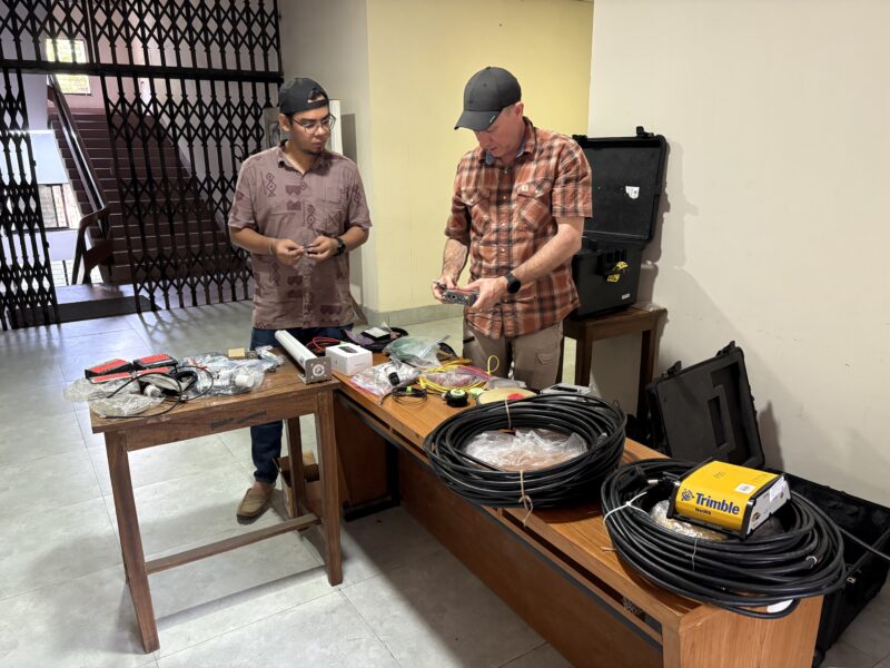
Reaching Dhaka, we hit lots of traffic, but finally made it to our hotel. Although it was the weekend, we spent the next day at Dhaka University. We assembled the cases for the new stations that we will install, and practiced programming the receivers and modems. Finally, it was time for Woolace to leave for the airport to return home. Ahmed, Singha and I will have to service the other stations on our own.
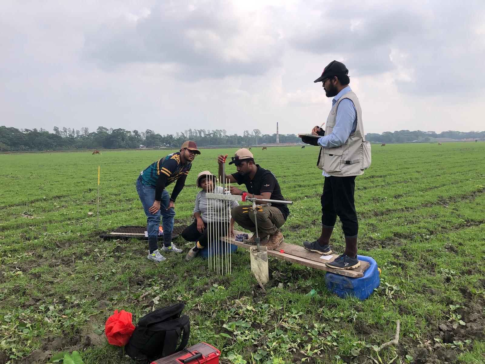
In the morning, Carol Wilson from Louisiana State University and her student Amaya Wanniarachchi arrived, and I had more meetings. Wilson and Wanniarachchi will be making measurements at RSET-MH (rod surface elevation tables–marker horizons) instruments that are co-located with my GNSS. The RSETs measure surface elevation changes relative to a rod driven up to 80 feet into the ground, while the MH measure sedimentation. The difference corresponds to shallow subsidence above the base of the rod. This complements my GNSS, which measures the deep subsidence below the building it is attached to. I have one GNSS on an RSET rod so our measurements together measure to total subsidence.
My second stay in Dhaka culminated with dinner at the apartment of Humayun Akhter, my long-term and closest collaborator in Bangladesh. He retired last year, resigning from his position as vice chancellor of Bangladesh Open University after the July-August uprising that toppled the government. We spent a lot of time in the field together on multiple types of studies. We had a lot of excellent conversation and delicious food for our last night.

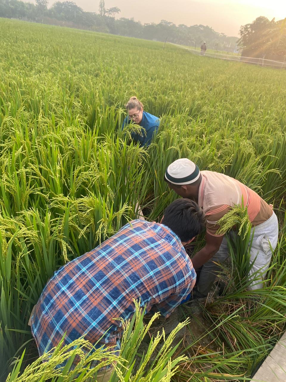
The next morning we were up at dawn to get an early start on our long drive and to get out of Dhaka before the traffic picked up. There were now seven of us in two vans. Ahmed and I with our driver, Babu, are the GNSS team. Wilson, Wanniarachchi, Md. Solaiman, A.A. Tanvir and Md. Jobayer are the RSET team with their driver Rafiq. Many Bangladeshis go by the middle or last name as Mohammed is a common first name. Our first stop was near the coast about 200 km to the south as the crow flies. Even though the new bridge over the Padma River and the four bridges over smaller rivers that we need to cross saves many hours, it would still take seven hours for us to drive.
We arrived at the guest house of the weather radar station in Khepupara in the late afternoon, along with Solaiman who was riding with us, while the other van went on to the RSET at Kuakata, the beach town where we will spend the night. Although we were able to do some repairs, the low-voltage disconnect to improve battery life was giving us error messages. We tried a number of schemes to rewire the system to correct it, but nothing worked. After sunset, we decided to call it a night. We would have to return in the morning.
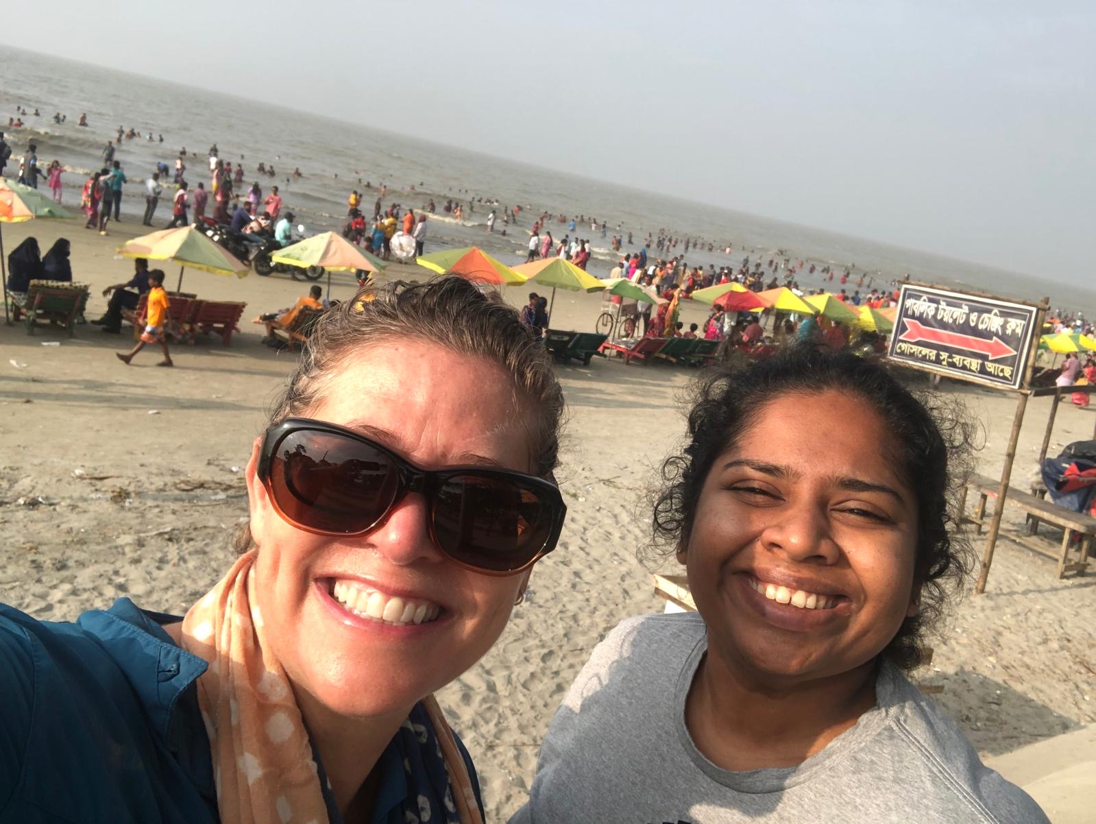
After dinner at our hotel, we went for a walk on the beach. It was crowded with vacationers. The streets were filled with souvenir shops, fast food stands and amusement rides. We walked on the sand along the beach between the giant sandbags to protect it from further erosion and the surf. What was unusual was that the water was fresh. The flow from the great rivers of Bangladesh hugs the coast here and pushes the salt water offshore.
In the morning, we found that Rafiq’s van needed repairs, so we all crowded into Babu’s van with the equipment we needed for the day while the luggage stayed with Rafiq. Checking with Woolace, we confirmed my suspicion that the error was due to a bad battery. The whole team had to come to our station and watch while we swapped batteries. The fix worked and we were soon back on our way.
We dropped the RSET team off at their installation at Patuakhali. Our Patuakhali station is one of the few that is working, so we continued north to Barishal. My student, Hasnat, who is also a professor at Barishal University, used a campaign GNSS kit to set up a continuous station on the roof using a rod that we installed previously. It was not working because someone cleaning the roof put the solar panel face down. We were welcomed to the Department of Geology and Mining by the chairman and fed a lunch of beef biryani. By the time we got to the roof, we could not finish before dark with sunset at 5:30 p.m. We managed to build aluminum frames to hold two solar panels with our drill and angle grinder, but it took so long that we could not finish the equipment case and headed to Barisal for the night.
The mechanic in Kuakata made Rafiq’s van worse. A friend of his from Barishal would take over the driving for the RSET team. He had to drive to Kuakata to get the luggage and then to Patuakhali for the team members. We all arrived at the hotel together. After a much-needed shower, we all walked to a famous kacchi (goat) biryani restaurant for dinner.
In the morning, we left even earlier than the RSET team since we had to return to the university to finish the job before the long drive west to the next stations. They gave Ahmed the keys to the roof so we could get a very early start. We got everything but the modem to work before we gave up. Since this is an extra station and not part of the paired GNSS-RSET network, we let it go to try to catch up to the RSET team. Ahmed and I are learning to diagnose problems and do repairs without Woolace, thanks to his training and knowledge of multiple ways to get things done. We are just running behind the RSET team, so far.
Views and opinions expressed here are those of the authors, and do not necessarily reflect the official position of the Columbia Climate School, Earth Institute or Columbia University.
Source link
Mike Steckler news.climate.columbia.edu