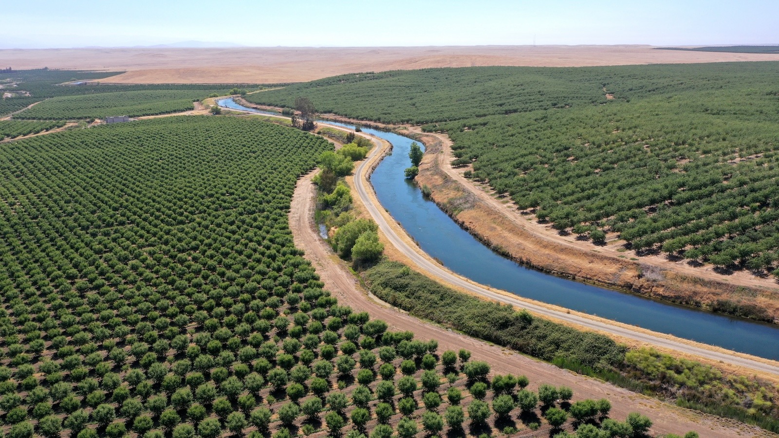
In parts of California’s Central Valley, so much groundwater has been pumped out of the ground to deal with the region’s persistent drought that the land is starting to sink in. Underground aquifers — layers of sand, gravel, clay, and water — are vital resources that communities can turn to when surface water is scarce. But when more water is pumped out of aquifers than is put back in — as is happening in the southern part of the valley — it can cause the ground to slowly contract, like a drying sponge.
After studying this phenomenon, Rosemary Knight, a professor of geophysics at the Stanford Doerr School of Sustainability, became interested in identifying the fastest ways to replenish California’s groundwater using managed aquifer recharge. This technique involves flooding a piece of land with excess surface water and allowing that water to seep through the ground and into aquifers, where it can be stored for later use. Armed with a massive electromagnetic dataset, Knight and a team of researchers set out to analyze sediment types below the surface in the California Central Valley and map out the quickest routes to refilling aquifers.
Their research, published last month in the journal Earth and Space Science, found that between 2 million and 7 million acres of land in the Central Valley are suitable for recharge — or between 19 and 56 percent of the valley’s total area. Most of the rechargeable land is currently used to grow crops. Many farmers are enthused about the data, according to Knight — and keen to implement it. As climate change continues to exacerbate water challenges in California, her team’s research points to how agricultural producers can help to ensure sustainable water access for all. “They want to be part of the solution,” said Knight.
Since 2000, the U.S. Southwest has been in the driest 25-year period the region has seen in over a millennium, according to researchers at the University of California, Los Angeles, who found that climate change has supercharged these dry conditions. Part of the way rising global temperatures exacerbate water challenges is by increasing the evaporation of surface water, or water in rivers, lakes, and reservoirs. Scientists are also eyeing how climate change could impact snowpack in the Sierra Nevada mountain range, which forms a critical part of California’s annual water supply every spring as it melts and moves into rivers and streams. In 2015, a multiyear drought in California led to an unprecedented decline in snowpack in the Sierra Nevada; researchers have also predicted that global warming could cause snowlines on the Sierra Nevada to rise towards the end of the century, meaning snow would only form at higher elevations, reducing the overall amount of snow on the mountain range.
Water is critical for the region because the Central Valley is an agricultural powerhouse, producing one-fourth of the nation’s food, according to the U.S. Geological Survey. It’s home to more than 250 different crops — from hay and cotton to rice and corn to tomatoes and olives. But the state’s agricultural industry has also been blamed for depleting groundwater while wells run dry in nearby rural communities. Over the past two decades, groundwater levels in California have been steadily falling, despite aquifers being periodically recharged naturally by snowmelt and rainfall, according to a 2022 study in Nature Communications.
“Natural recharge was not keeping pace with the rate of extraction,” said Knight.
Citizens of the Planet / Education Images / Universal Images Group via Getty Images
In order to determine how water would flow through sediments below the ground, Knight and her colleagues used a large set of electromagnetic data acquired by the California Department of Water Resources. The data was collected by helicopters flying over the Central Valley in a grid formation, with flightlines spaced a few miles apart. Using special equipment that sends an electromagnetic signal into the ground, the choppers were able to determine how the current is conducted through layers of soil at a depth of up to 300 meters. Areas full of coarse materials like sand and gravel — where water flows seamlessly — can’t conduct electricity easily.
By interpreting these results, the researchers were able to construct a 3D model of the subsurface and pinpoint “fastpaths” for water to travel down into aquifers.
This kind of information could be vital for regional California agencies, which have been instructed to develop plans for using groundwater more efficiently under the state’s Sustainable Groundwater Management Act. The data that Knight and her colleagues produced — which they’ve made available online — can also help agricultural producers decide whether or not to implement groundwater recharge on their lands. Their analysis reveals which specific croplands are best suited for recharging aquifers (like the ones used to grow fruits, nuts, and field crops, as well as vineyards) and which aren’t (those used for rice and citrus).
This level of soil data can help farmers make decisions about whether managed recharge is right for their land. “Growers really want to have confidence that if their land is being flooded for recharge, that water is going to very rapidly move below the ground surface,” said Knight. Better guidance for agricultural producers has already been circulating; the Almond Board of California has been recommending groundwater recharge for a few years now and published an introductory guide for growers.
Christine Gemperle, a longtime almond grower who sits on the Almond Board of California, has flooded one of her orchards twice for groundwater recharge — and said she has seen numerous benefits beyond raising groundwater levels in her area. They include flushing gophers out of her fields (they love her cover crops, Gemperle said) and pushing salts that accumulate from irrigation further down into the soil. Although she wasn’t able to do it this winter, due to dry conditions lowering the amount of surface water available, she feels optimistic that this kind of data can empower other farmers to explore recharge. “There’s so much opportunity,” she said.
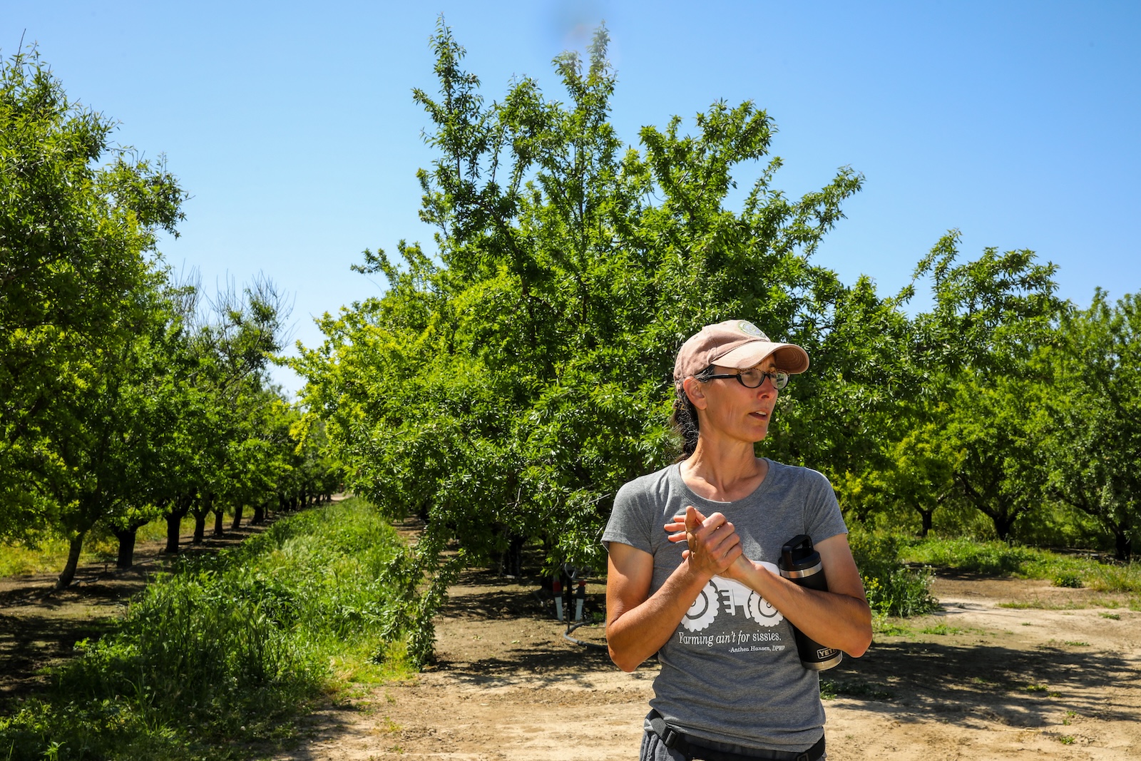
Yolanda M. James / The San Francisco Chronicle via Getty Images
Like many farmers in the state, Gemperle already had access to canals that transport water from a reservoir to her fields for irrigation. This made recharge fairly straightforward: When she saw the canals were full of water during a particularly wet year, she got permission from her local irrigation district to open the canal gates and flood her land. The prevalence of this kind of infrastructure is an advantage for California farmers interested in recharge, according to Shimon Anisfeld, a professor at the Yale School of the Environment focused on water management who was not involved in Knight’s study.
Managed recharge can provide some “environmental win-wins,” said Anisfeld. When farmers face wet winters and dry summers, recharge can help store excess surface water, making it accessible during the growing season. In certain instances, like when farmlands are restored into floodplains, aquifer recharge can also double as habitat restoration for wildlife.
Farmers are likely to be motivated to dedicate some of their land to aquifer recharge, said Anisfeld, especially if they can reap the benefits later.
Still, he suggested, Californians will likely need to tackle its water challenges by decreasing demand as much as boosting supply. “I’m not convinced that recharge is going to be a substitute for reducing water use,” he said. “I don’t think it can, on its own, solve the whole problem.” Managed aquifer recharge may be a more attractive option for farmers than the alternative of changing their agricultural practices. “If you can recharge groundwater, that gives you more to work with,” Anisfeld said. “It means you can keep on farming and keep on growing water-intensive crops.”
Knight agreed that growers don’t “want to stop pumping” groundwater or have to fallow their fields. She hopes that by publishing a version of their data online and making it accessible to the public, her team will help empower individual stakeholders to explore the options that are best for their soil.
“I care about actionable data presented in a way that is helpful to end users, such as growers, managers of water districts,” she said. That way, “the user can make their own decisions about how best to use the results.”
As for Gemperle, she sees flooding her farmland as a way to ensure that her community continues to have access to water. “I see it as something that really points to how connected we are in this agricultural landscape,” she said. “We are more connected than disconnected.”
Source link
Frida Garza grist.org