
Earlier this summer, the Banana Lake Fire erupted near Plains, Montana, engulfing over 850 acres in flames within a day. The “total suppression” response from firefighting officials included deploying at least 17 engines, two helicopters, and three bulldozers, as well as highly trained fire crews. But another newer piece of technology was also at play as firefighters worked to contain the blaze: drones.
Banana Lake was one of several early-season fires in the state this year. As of this writing, there are over 20,000 acres burning across seven key wildfires in Montana, at varying levels of containment. And increasingly hot and dry conditions throughout the American West are making fire an ever more fickle foe.
As a new era with the natural disaster commences, both fire practitioners and researchers across the West are bolstering their arsenal with cutting-edge tools. Drones now fly above firefighters, private satellite companies monitor fire and smoke from above, and AI machine-learning models are helping to advance fire research. While these new innovations are not panaceas, ground operations crews and scientists are optimistic about the ways modern technology can help fight fire smarter, not harder.
Since 2018, drones — sometimes referred to as unmanned aerial systems, or UAS — have been flying under the radar as a new instrument for the United States Forest Service in the fight against wildfire. Thanks in large part to Dirk Giles, who launched and leads the agency’s UAS program, the number of drones deployed each year by the Forest Service has jumped from 734 flights in 2019 to over 17,000 in 2024.
“The program has really hit a new stride in the past three years,” said Giles. “We are seeing UAS supplementing fire crews across all phases of response.”
“This UAS program is now being recognized as prolific,” said Ry Phipps, a division supervisor in Region 1 of the Forest Service, which includes Montana. “There was a time we wouldn’t have even thought to try and order a drone for operations. They have become a fantastic tool that is changing the game.”
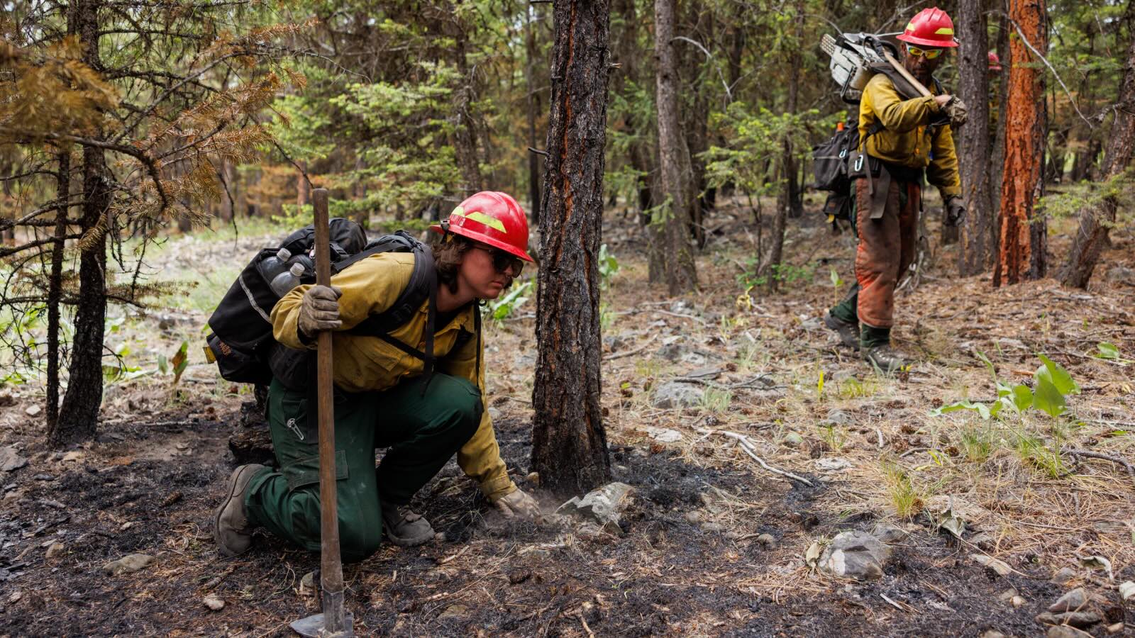
John Stember
According to Phipps, drones are increasingly seen as a force multiplier by Forest Service employees. Drones equipped with infrared sensors can help detect lingering hot spots, pinpointing areas at risk for reigniting. Previously, firefighters had to meticulously hand-check burn scars, which could take days at a time and a ton of manpower depending on the size of the area. With supervisors like Phipps reading a thermal map on a screen fed by drone data, firefighters with boots on the ground can be dispatched more safely and efficiently, only going to spots that have high heat signatures.
“It saves a lot of time and risk for crews,” said Phipps.
For helicopter pilots, who help control wildfires by dropping water or fire retardant to suppress flames and creating fire lines for ground crews to control blazes, drones can also assist. Preprogrammed flight trajectories in combination with infrared sensors allow UAS to fly through heavy smoke or at night. This mitigates the need for “low and slow” reconnaissance missions, which require pilots to fly close to the ground in tricky terrain and low visibility. According to Giles, these missions are some of the most dangerous for wildland fire pilots. As their name would suggest, unmanned aerial systems offer a way to do surveillance without putting pilots in danger — which means that UAS can unlock new abilities for fire crews in extreme conditions.
“Basically, you can fly drones so that nobody gets hurt,” said Phipps. “You can replace a drone. You can’t replace a person.”
Although Giles, Phipps, and others believe that drones show great promise — especially in shifting risk from firefighters to a machine the size of a small cooler — they’re far from being a silver bullet. The machines have limited battery life and can only complete flights of about 15 minutes on average, meaning that deployments must be carefully planned. And since drones are still being studied in various fire management applications, manpower is still needed to check the “ground truth” of information that UAS provide.
Another limitation is simply availability. According to Phipps, there aren’t as many drones as there is demand for them.
Ironically, there’s also an emerging risk from privately owned drones getting in the way of official operations. If hobby drones are in the airspace near a wildfire, it’s also a no-go for land management agencies to fly. During a wildfire in Montana in 2022, aerial crew operations came to a standstill as an unapproved drone buzzed right into an area with a temporary flight restriction. Officials were able to locate the drone’s owner in just about 15 minutes — but that’s precious time when a fire is raging.
And just two weeks ago during a wildfire near Provo, Utah, fire operations were shut down by multiple drone incursions, impeding fire management on a high-profile fire near a densely populated community. While UAS are becoming more critical in fire operations, officials must also work on educating civilians to ensure unauthorized drones don’t prevent them from flying their own.
John Stember
Another area of fire management that drones have shown shown some promise in is lighting and managing controlled burns — intentional blazes set to clear dry brush and other fuels.
Fire management’s history of suppression disrupted the natural fire cycles that Indigenous communities once stewarded — cycles that many ecologists now champion. As colonization spread across the West and settlers sought to control land and resources, racist assimilation programs criminalized all manner of Indigenous customs. Prescribed burning was one of them.
But as the consequences of this more aggressive, reactive approach to fire management have become apparent, Western science has increasingly caught on to the effectiveness of routine controlled burning. One recent Stanford-led study revealed that prescribed burns can reduce the severity of subsequent wildfires by an average of 16 percent and net smoke pollution by 14 percent. Fire professionals have also recognized their potential, with applications growing year over year.
Enter another new breed of drones: UAS that can be equipped to carry “dragon eggs,” pingpong ball-sized clusters of a flammable potassium concoction that ignite on impact. This innovation helped the Forest Service burn around 189,000 acres in 2024 to reduce built-up fuels.
While the use of prescribed burns is on the rise, in Montana and elsewhere, concerns remain about public safety risks, both from air pollution and the possibility of blazes getting out of control. Technology is helping to address those kinds of questions, too.
Researchers in Montana are looking to clear some of the lingering haze of safety concerns around prescribed burns through a National Science Foundation-funded project titled SMART FIRES. (The project’s title is an acronym for Sensors, Machine Learning, and Artificial Intelligence in Real Time Fire Science.) The group, specializing in fields from atmospheric chemistry to public health, will use the grant to conduct five years of study and fieldwork aimed at unpacking the environmental and social dynamics needed to scale prescribed burns as a preventative measure for wildfire. The suite of custom gadgets that the project is utilizing includes some proprietary UAS.
“Drones are just a tool,” said John Sheppard, who leads SMART FIRES’ AI computer science team. He added that his role in the project is a supportive one — to see how these technological tools can further the various research aims.
Using smart sensors and high-resolution cameras fastened on drones and ground sites, the researchers are training AI models to analyze prescribed burns on the fly. The different smart sensors will efficiently process real-time data, and in combination with weather and historical fire information, they will look to model a burn’s movement on the landscape.
Before conducting a prescribed burn, practitioners usually carefully examine environmental factors like wind, humidity, and temperature. These AI models will theoretically offer an enhanced version of that, also incorporating factors like ground fuels and topography to provide supervisors with the best possible data to burn accurately and safely.
SMART FIRES also touts a “science lab on wheels” — a tricked-out Ford Transit van that looks right off a Ghostbusters movie set. The van collects smoke directly from active fires, which environmental chemists then analyze to determine things like the level of PM2.5 — particulate matter smaller than 2.5 microns, a concern for public health — and other pollutants present in the smoke.
The social science arm of the project will also engage community members, surveying rural and Indigenous communities in particular about their concerns and priorities related to prescribed burns and ensuring these considerations are put into risk assessments. The consortium ultimately hopes to provide interpretable, map-based forecasts to land managers to help them decide when, where, and how prescribed burns can be used for wildfire prevention.
“The goal of the project is to refine the AI models so that they can give better recommendations to experts on the ground who know best,” said Sheppard.
While drones and AI are opening up a new era for fire science and management, some of the most tenured experts on the ground have yet to gain access to these types of cutting-edge tools.
The Confederated Salish and Kootenai Tribes of Montana, sometimes known by the acronym CSKT, have practiced prescribed burns as a tool for land stewardship since time immemorial. According to Ron Swaney, the fire management officer of the CSKT Division of Fire, the role of fire has long been guided by a deep cultural responsibility. “I think a lot of people underestimate the role of Indigenous burning on the landscape,” he said. “There was purpose and intent for that use of fire.”
Justin Underwood, the CSKT prescribed fire and fuel specialist, has been in fire management for 19 years and was the first UAS pilot to be certified under the Bureau of Indian Affairs in the Pacific Northwest region. For three years, he has been trying to get a drone for the tribes’ prescribed burn operations. But because he isn’t employed by the Department of the Interior, he has yet to cut through the red tape.
The Office of Aviation Services, which lives within the U.S. Department of the Interior, is responsible for all aircraft services and facilities — including the certification card needed for flying a UAS. According to Swaney, the tribe has a helicopter, two single-engine air tankers, and an air attack platform for firefighting. But because drones are a newer implementation in fire management, nonfederal fire divisions may run up against a convoluted process to get clearance to use a UAS.
“I wouldn’t be so frustrated if my qualifications didn’t mirror other pilots,” said Underwood. “I’ve done every training offered by the Department of the Interior, but I am still unsure what it will take to get officially carded for a UAS.”
While the CSKT coordinates with public land agencies on prescribed burns, the tribal nation sets its own fire management plan — one part of a larger plan focused on climate change adaptation. The tribe’s approach to fire weaves together ancestral knowledge and contemporary science. But being unable to utilize the latest technological tools has hampered these efforts, Swaney said, underscoring just how important the role of technology is in present and future fire management.
“It’s like living in the dark ages,” said Swaney.
Source link
Emily Senkosky grist.org