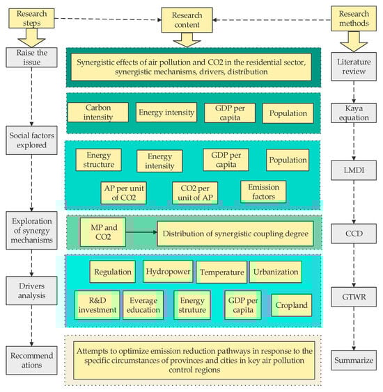
5.1. Overview of Total Emissions
The emission rates of AP and CO
2 from the residential sector exhibited an overall decrease (
Figure 3), particularly post-2013, with negative growth except for NH
3. The CO
2 levels did not decrease, and CO
2 represented a growing proportion (as much as 80%) of the total residential emissions (
Figure 4d). The 30 provinces and cities were categorized into northern and southern regions based on the Qinling–Huaihe River Line. The data indicate that air pollutant emissions from residential areas in the south have consistently exceeded those from the northern regions, and this disparity has gradually widened since 2015. CO
2 emissions were higher in the northern regions; however, post-2015, emissions in the north declined. In contrast, in residential areas in the southern regions, emissions maintained the same growth trajectory, leading to a reduction in the disparity between the two regions. Furthermore, as shown in
Figure 5, the disparity in emissions between the north and south continued to increase from 2016 to 2020. A significant portion of pollutant emissions from residential areas stems from coal consumption (
Figure 4a–c); pollution from coal consumption accounts for 70–57% (average of 30 provinces) of residential emissions.
In 2020, 50% of the pollutant emissions (AP and CO
2) from the residential sector (
Figure 5) in the north stemmed from coal combustion, compared with 30% of emissions in the south, indicating that northern residents are more dependent on coal for fuel use. Specifically, pollution sources in the northern region exhibited significant regional variations; for example, residential emissions (AP and CO
2) constituted over 70% of the emissions in Beijing and Tianjin but only 57% in Hebei (
Figure 6). In Shanxi, Inner Mongolia, Liaoning, Jilin, Heilongjiang, and Xinjiang, coal use accounted for 76%, 90%, 64%, 77%, 87%, and 78% of the total emissions, respectively (
Figure 6). Tibet is an exception, with 98% of the air-borne pollution emanating from biofuel combustion (
Figure 6). In the south, a very large proportion of emissions were attributed to coal use: 71% in Hubei, 83% in Hunan, 94% in Guizhou, and 81% in Yunnan. In Shanghai, Zhejiang, Jiangsu, and Guangdong, the residential sources accounted for 98%, 89%, 81%, and 86% of the total pollutant emissions, respectively (
Figure 6). Regarding the total emissions of AP and CO
2, Guizhou ranked first, Heilongjiang second, and Hunan third (
Figure 7). In these three provinces, 80% of the pollution is attributed to coal use (
Figure 6). Notably, Guizhou and Hunan are part of the southern region. In conclusion, pollution emissions from coal use were higher in the northern region than in the southern region. Of the 30 provinces and cities, 12 had more than 50% of their residential pollution emissions stemming from coal use, and 17 had more than 50% from other residential sources, indicating that, beyond the use of coal and biomass fuels, other daily activities of residents are also a significant source of pollution. Regarding regional distribution, pollution sources have deviated significantly from the traditional north–south zoning pattern.
5.2. Air Pollution Emission Factors and Regional Differences
To understand the social factors influencing emissions in the residential sector, this paper analyzes and compares the contributions of various social factors to emissions while also examining regional disparities.
In the residential sector, the CO
2 emissions were significantly higher than the AP emissions, resulting in low H values (
Table 1 the LMDI decomposition results are unitless) and high C values (except for SO
2 and NH
3). Consequently, the emissions of CO
2 per unit of air pollutant (R) are a substantial contributor to the overall pollution emissions. Energy structure (S
t) and intensity (S
o) exert an inhibitory effect on pollutant emissions. However, this effect is minor, with air pollutant emissions being more significantly influenced by population size (
Table 1, Z value) than by GDP per capita (
Table 1, E value). In conclusion, the energy emission factor (P) and population (Z) contribute significantly to pollutant emissions and represent the primary focus of future emission reduction efforts. In particular, the goal should be to reduce the energy emission factor through energy substitution or upgrading residential energy use, as well as prioritize emission reductions in provinces and cities with large population bases, taking into consideration population distribution characteristics. In addition to reducing NH
3 and other pollutants, synergistic emission reduction possibilities (H+R) exist. However, to date, no such synergistic emission reduction has been achieved.
Z contributed to pollutant emissions in both the south and north and the value of Z gradually decreased in the north while it increased in the south (
Figure 8). Notably, after 2015, the Z-values (
Table 2) were significantly higher in the south than in the north, indicating that planning the residential sector to reduce emissions based on population distribution is more effective in the southern regions. The synergistic effect of AP and CO
2 (H+R) increased in both the south and north, and the magnitude of the increase in the south was significantly higher than that in the northern region. Particularly after 2015, the R-value (
Table 2) was considerably higher in the southern region than in the northern region. This indicates that the contribution of AP due to the increase in CO
2 emissions in the south after 2015 was much larger than that in the north. Additionally, P transitioned from a reducing effect to a facilitating effect, and in terms of the emissions of particulate matter other than PM
2.5, the value of P in the southern provinces and municipalities was significantly higher than that in the northern region. These findings suggest that the emission factors in the southern region play a significant role in pollutant emissions. Given that population size has a greater impact on the southern region, it is advisable to prioritize the implementation of energy upgrading and replacement policies in the southern region, where there are larger population centers. This approach is likely to be more effective at reducing pollutant emissions.
As discussed in
Section 5.1, the spatial distribution of pollution sources from the residential sector has shifted away from the traditional north–south division. To better analyze the spatial distribution of the promoting effects of social factors on emissions, we have grouped the LMDI decomposition results using radar charts.
Figure 9 illustrates (detailed data in
Table 3) that the contribution of seven factors to PM
2.5 emissions in 30 provinces indicates that these provinces could be divided into four types. The first type is characterized by a high population factor (Z), which significantly influences emissions. In the provinces of Beijing, Tianjin, Hebei, Shanxi, Henan, Shandong, Shaanxi, Zhejiang, Jiangxi, Guangdong, and Yunnan, urban planners should address the high residential emissions stemming from large populations. The second type comprises provinces with a high R-value (CO
2 emissions per unit of AP), signifying an imbalance between AP and CO
2. This category includes Liaoning, Gansu, Ningxia, Qinghai, Xinjiang, Shanghai, Hubei, and Hunan provinces. The third category includes provinces with high-emission factors (P), necessitating improvements in residential energy structures and stoves to reduce emissions. This group included Hainan, Guizhou, Sichuan, Yunnan, Chongqing, Guangxi, Jiangsu, Fujian, and Anhui. The fourth type, referred to as the mixed type, includes Jilin, Inner Mongolia, and Heilongjiang.
5.4. Drivers of Coupling Coordination Degree
To further explore the mechanisms of synergistic emission reduction in the residential sector, we employed the GTWR model to analyze the driving factors. The variable selection process was carried out in two stages: Initial Screening: Variables were initially drawn from two sources. First, we included key factors from the LMDI model, such as the residential sector emissions factor, energy composition, energy efficiency, GDP per capita, and population size. Second, we incorporated additional factors that are commonly examined in emission-related studies, such as income disparity [
94], environmental regulation [
28], the digital economy [
95], population density [
96], average years of education [
97], years of tertiary education [
97], urbanization rate [
98], NDVI [
99], and R&D investment [
74]. Final Selection: To avoid multicollinearity, all variables underwent a variance inflation factor (VIF) test (
Table 4). Based on this test, the following variables were selected: GDP per capita, hydroelectricity generation, environmental regulation, population size, temperature, urbanization rate, average years of education, R&D investment, and electricity consumption (
Table 5).
The GTWR model constructed with these variables demonstrated strong performance, achieving an adjusted R
2 of 0.885 and the lowest AICc value among the tested models (
Table 6).
Table 4.
VIF test.
| Variable | VIF | 1/VIF |
|---|
| Everage education | 4.75 | 0.210596 |
| GDP per capita | 4.03 | 0.24803 |
| R&D investment | 4.02 | 0.248718 |
| Urbanization | 3.44 | 0.290978 |
| Cropland | 2.42 | 0.412516 |
| Temperature | 1.82 | 0.548412 |
| Regulation | 1.23 | 0.816154 |
| Energy structure | 1.15 | 0.871267 |
| Hydropower | 1.14 | 0.877559 |
| Mean VIF | 2.67 | |
Table 5.
Statistical description.
Table 5.
Statistical description.
| Variable | Sample | Mean | Min | Max | Std. Dev. |
|---|
| CCD | 600 | 0.23139 | 0 | 0.25 | 0.033472 |
| RD investment | 600 | 0.013976 | 0.001514 | 0.064444 | 0.010801 |
| Regulation | 600 | 0.004379 | 0.000085 | 0.030988 | 0.003758 |
| Everage education | 600 | 8.664195 | 6.04047 | 12.782 | 1.059097 |
| Energy structure | 600 | 0.033317 | 0.0029 | 0.1097 | 0.023423 |
| Hydropower | 599 | 256.5179 | 0 | 3541.38 | 491.7662 |
| GDP per capita | 600 | 10,257.26 | 2743.874 | 29,039.82 | 5501.658 |
| Cropland | 600 | 1059.427 | 42.69406 | 5417.912 | 896.716 |
| Temperature | 600 | 12.41496 | −4.0224 | 25.07904 | 6.002517 |
| Urbanization | 600 | 0.517295 | 0.1389 | 0.896 | 0.155166 |
Table 6.
Comparison of regression results.
Table 6.
Comparison of regression results.
| Model | R2 | Adjusted R2 | AICc | Bandwidth |
|---|
| OLS | 0.279 | — | 1525.791 | — |
| GWR | 0.768 | 0.764 | 983.535 | 0.115 |
| GTWR | 0.887 | 0.885 | 720.642 | 0.115 |
Figure 10a–i presents the spatial distribution of the regression results from the GWTR model, reflecting the influence of the selected social factors on CCD in each province and city. A positive coefficient indicates promotion, while a negative coefficient indicates weakening.
Figure 10a–i corresponds to the following social factors: R&D investment, environmental regulation, average years of education, energy structure, GDP per capita, per capita cropland, hydroelectricity generation, temperature, and urbanization. For detailed coefficients for each province and city, please refer to
Table 7.
The share of research and development expenditures (R&D investment) in GDP indicates the level of importance that a region assigns to innovation and affects the emissions of the residential sector [
74]. As
Figure 10a shows, an increase in the share of R&D investment exerts both positive and negative effects on coordination coupling across different regions. Weakening effects were evident in 7 of the 28 provinces, which were all in the southern region: Shanghai, Zhejiang, Fujian, Jiangxi, Hunan, Guangdong, and Hainan. Conversely, the coefficients for Sichuan (0.672), Chongqing (0.646), and Guizhou (0.887) were significantly larger, suggesting that R&D investment in these three provinces can substantially reduce the emissions of residents. In Qinghai, Gansu, Shaanxi, Hebei, Tianjin, Beijing, Shandong, and Henan, the CCD increased by 0.169–0.344 for each percentage point increase in the proportion of R&D investment.
Previous studies [
71] have shown that the management of industrial pollution contributes to rural energy transitions and increases the environmental awareness of the population. Accordingly, we included the ratio of investment in industrial pollution control to the industrial added value as a factor in the model.
Figure 10b shows the coefficients indicating the impact of the government’s investment in industrial pollution control as a proportion of industrial added value on the degree of coordinated coupling. The promotion and weakening effects were distinctly and spatially clustered. Shaanxi, Gansu, Qinghai, Ningxia, Shanxi, Hebei, and Inner Mongolia, all in the northern region, showed enhanced effects, indicating that the government’s efforts in industrial pollution control in these provinces have contributed to the reduction in emissions. Twenty-one provinces and cities exhibited a weakening effect, particularly along the southeastern coast.
Higher education correlated with greater environmental awareness but did not guarantee eco-friendly behaviors because of factors such as personal values, cultural contexts, and economic incentives [
100]. In this study, we calculated the effect of the average years of education on coordinated coupling. As shown in
Figure 10c, the average number of years of education has both promoting and weakening effects on coordinated coupling. In Beijing, Tianjin, Hebei, Inner Mongolia, Shandong, Chongqing, Sichuan, Guizhou, and Qinghai, the average number of years of education weakened coordinated coupling, suggesting that in these regions, the average number of years of education had a negative effect on emissions from the residential sector rather than reducing both in the same direction. In six provinces and municipalities, the average years of education increased the CCD by 0.267 to 0.481 in Heilongjiang and Jilin and by 0.122 to 0.267 per year in Henan, Shaanxi, Yunnan, and Guangxi.
Electricity consumption, as a portion of total energy consumption, is a measure of the energy mix; an increase in the share of electricity consumption means that electricity has replaced traditional solid fuels (e.g., firewood and coal) for heating and cooking, resulting in reduced AP emissions from households [
101]. As shown in
Figure 10d, the energy mix in all provinces and cities, except for Sichuan, Gansu, Jilin, and Heilongjiang, contributed to the development of harmonization and coupling, which indicates that an increase in the share of electricity consumption in most provinces and cities led to a reduction in emissions. In the southeast, including Guangxi, Guangdong, Fujian, and Hainan, the CCD increased from 0.327 to 0.480 for every percentage point increase in the share of the electricity consumption structure. Similarly, in Guizhou, Hunan, Hubei, Anhui, Zhejiang, Jiangsu, and Jiangxi, the CCD increases from 0.209 to 0.327 for each percentage point increase in the share of the electricity consumption structure.
Hydropower directly reduces the use of fossil fuels, thereby reducing the residential AP and CO
2 emissions. However, hydropower has regional variability. Provinces and cities rich in hydropower resources have a greater potential to reduce carbon emissions and air pollution, whereas regions dependent on fossil fuels for power generation have less potential [
102]. As shown in
Figure 10g, each percentage increase in the proportion of hydroelectric power generation led to an increase in the CCD, ranging from 2.431 to 0.071 in Heilongjiang, Jilin, Liaoning, and most provinces and cities in the southeast, with Jiangsu and Zhejiang being significant contributors, enhancing the degree of coupling. This suggests that increasing the proportion of hydropower generation in the southeastern and northeastern provinces could lead to reductions in emissions from the resident population. Weaker effects were observed in Beijing, Tianjin, Inner Mongolia, Shanghai, Guangxi, Chongqing, Guizhou, Qinghai, and Ningxia.
The relationship between per-capita GDP and air pollution differs across regions. In the study by Xu [
103], GDP per capita was considered to have a negative effect, except in the Beijing–Tianjin–Hebei region, Yangtze River Delta, and South China, where it is believed to have a positive effect. Aslam [
104] found that GDP per capita negatively affects CO
2 emissions, whereas the square of the GDP per capita positively impacts CO
2 emissions. In this study, except for the Sichuan and Qinghai regions, GDP per capita was found to exert a weakening effect on coordinated coupling (
Figure 10e). This result suggests that in most regions, GDP per capita does not simultaneously promote the reduction of residential air pollution and CO
2. Furthermore, the distribution of this influence in terms of strength was spatially clustered. In the southeastern regions, including Shandong, Henan, Hubei, Hunan, Jiangsu, Anhui, Zhejiang, Fujian, Jiangxi, and Guangdong, the CCD decreased by 0.954–0.780 for each unit increase in GDP per capita. In Heilongjiang, Jilin, Liaoning, Hebei, Tianjin, Beijing, and Shanxi, the CCD decreased from 0.780 to 0.621 for each unit increase in GDP per capita.
Cropland areas represent a potential reservoir of biomass fuel resources, which significantly influence residential fuel choices. Consequently, we assessed the cropland area as a possible influencing factor [
105]. As shown in
Figure 10f, in the western region (Guangxi, Guizhou, Chongqing, Shanxi, Ningxia, Gansu, Qinghai, and Sichuan), an increase in the per capita arable land area resulted in an increase in the degree of coupling coordination. This led to a decrease in the degree of coupling in the southeastern region and in North China. The east–west distribution of this difference was significant.
Temperature affects residential emissions through several pathways that influence energy demand, air pollution dispersion, residential activity patterns, and chemical reactions involving pollutants. As depicted in
Figure 10h, temperature had a weakening effect on the synergistic emission reduction in the southeastern region and a promoting effect on the CCD in the western region, particularly in Sichuan, Qinghai, Gansu, Ningxia, and Heilongjiang.
An increase in urban population typically leads to increased energy consumption and emissions. Although urbanization can, to some extent, mitigate the growth of emissions by enhancing energy use efficiency and upgrading the industrial structure, cities with high population densities tend to have more severe AP and CO
2 emission issues [
98,
106]. As shown in
Figure 10i, there was a significant difference between the eastern and western regions in terms of the impact of population distribution on the CCD. However, in contrast to the effect of temperature, the impact of per capita cropland on the degree of coupling coordination varied. The southeastern and northern parts of China were associated with a promotional effect, whereas the western part played a weakening role.
In summary, in the southeastern region, R&D investment, government investment in industrial pollution control, the proportion of electricity consumption, GDP per capita, cropland per capita, and temperature weakened the degree of CCD in the residential sector, whereas hydroelectricity generation and the proportion of the urban population enhanced the degree of coupling coordination. In the western region, R&D investment, government investment in industrial pollution control, the proportion of electricity consumption, cultivated land area per capita, temperature, and the proportion of the urban population contributed to the CCD. The average years of education in six provinces and cities, Heilongjiang, Jilin, Henan, Shaanxi, Yunnan, and Guangxi, had a boosting effect on the CCD.